Sailing away with Nikk and Jan

Archive for the ‘Traveling in Mexico’ Category

Las Hadas: History, Mystery and Celebration

P1130551


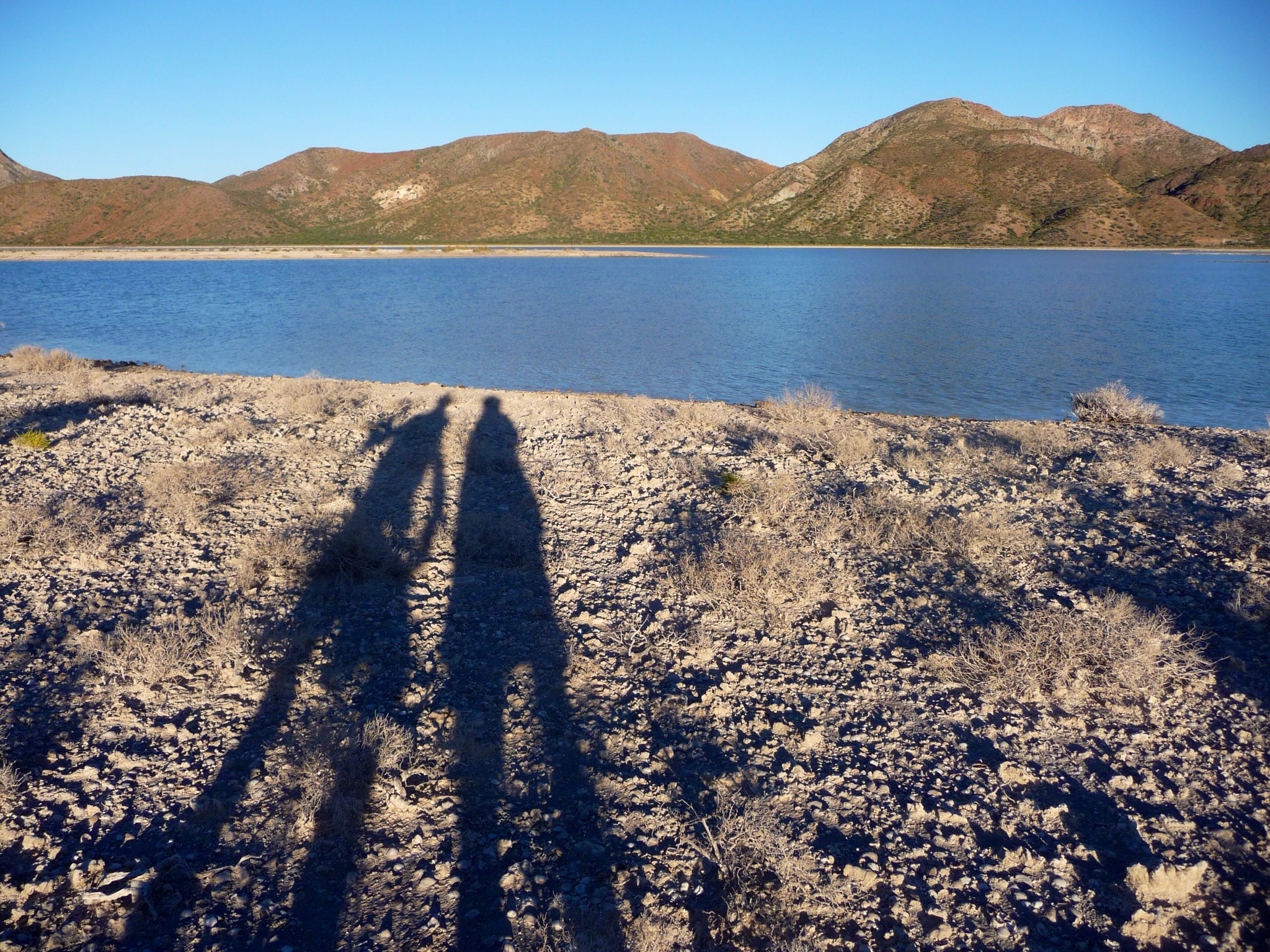
Have you ever seen a photograph of a location and knew you had to go there?  Nikk and I were planning our sailing trip south from La Cruz de Huanacaxtle in December when I spotted the photograph of Las Hadas Resort in Pacific Mexico:  A Cruiser’s Guidebook.  (http://bluelatitudepress.com)  That’s all it took for my mind to be hooked.  Usually my fascination centers on some aspect of the natural world, but this time my love of architecture, and Moorish architecture in particular had me planning and plotting a trip to Las Hadas.  Soon Nikk  somewhat merrily agreed to our off-boat adventure when I suggested that a two-night stay to celebrate my birthday at Las Hadas would be so romantic.  Balance sailed into the little cove in front of Las Hadas on January 4th, and we anchored in aquamarine water with only two other boats, one unoccupied.  Reservations were easy, using hotels.com.  This time we played it safe and transported ourselves, our luggage and our electronics in the dinghy, not the kayaks, to the marina located inside the breakwater.


P1130508

The hike from the marina up to the lobby involved some serious puffing and panting, as the road is steep and long, and we were hauling all the gear necessary for a two-day stay.  Luckily after checking in an employee ferried us in a golf cart up to our room, several floors and stories above the lobby.  After that ride, Nikk and I enjoyed hiking all over the resort, exploring and photographing, and puzzling the employees who constantly asked us if we wanted a ride.  Our room was small, but seemed roomy after three weeks on the boat.  Marble floors and counters, bas relief in Moorish styling on the door and the headboard designed on the wall, hot water (a happy luxury after the Grand Bay Marina restrooms with almost no hot water), WiFi  (a bit slow so no movies) and a luxurious large shower.

This Moorish fantasy was created by Antenor Patino Rodriguez, known as Antenor Patino, who was heir to his father’s title of “The King of Tin” in Bolivia.  I have learned that whenever I see a work of fantastic architecture in Spain, Central America or South America, the wealth that built it is likely to come from the extraction of resources, like tin, which involves the use of many poorly-paid workers or slaves.   Patino wanted to create a resort for his family and friends, and named it Las Hadas, which means “the fairies”, because of the sparkling, shiny particles in the sand, or maybe because of the glimpses of phosphorescence scintillating in the water.  Architect Jose Luis Ezquerra took Patino’s ideas and formed them into turrets, towers, whimsical sculpture, beautiful pools, and luxurious accommodations.  After Las Hadas was completed in 1972 a month-long celebration for the rich and famous ensued, and then three years of money-draining parties and what I sometimes call “wretched excess”, until Patino’s fortune was threatened and he sold Las Hadas.  Patino married into European royalty, so there were plenty of rich and famous people of his acquaintance to entertain and accommodate.   We were also amazed to have dinner back in La Cruz with Ed and Connie, who sail on Sirena, and to find that Ed grew up in Bolivia and knew Patino because his father was an American geologist.

Today the property is managed and cared for by the Las Brisas Hotel Collection, and they are doing an admirable job of keeping the aging resort from crumbling and losing its charm.  In our wanderings, we found places where Mother Nature had caused some serious problems recently, but the bulk of the hotel, with five restaurants, tennis courts, two pools, and many roads and buildings looked like maintenance was a serious and on-going priority.

Las Hadas became famous worldwide after the movie “10” with Bo Derek and Dudley Moore was filmed there and released in 1979.  Nikk’s son-in-law heard we were going to Las Hadas and immediately gave Nikk a long story on the phone of the teenage fantasies caused by Bo Derek at Las Hadas until his wife said “OK, moving on to other topics….”.

I’m not telling any secrets, but Nikk and I did have a romantic stay at Las Hadas, and celebrated my birthday with lobster ravioli, cheesecake and margaritas

P1130528

Sunrise

P1130523

A luxurious unit

P1130529

An echo of the Alhambra in Spain

P1130515

Holiday lights

On the third day, while walking near Los Hadas, we found a large abandoned house on an overgrown lot, with tropical thorn forest rapidly taking over the property.  Since it was for sale, we went exploring.  Why it was abandoned, who owned it, where they went, and how long before it’s razed and turned into another hotel were questions asked and not answered.  Las Hadas would soon resemble this decaying home if not for all the efforts to thwart entropy (the tendency of the universe to go to maximum randomness).  The contrast between this neglected property and Las Hadas became a meditation on the impermanence of all things, and on whether the birds, lizards, trees and shrubs were more beautiful than the carefully-tended creations of Las Hadas?

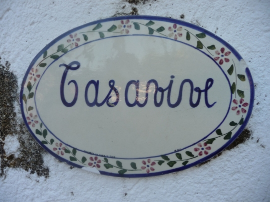
Even the name of the property is a mystery that is not solved yet.  The name on the plaque can’t be deciphered by anyone I’ve asked so far, including the Mexican waiter at Octopus’s Garden.  If any reader has a guess, please add it in the comments!


P1130573

Too soon it was time to head back to Balance, pull up the anchor, and slowly make our way back north to La Cruz.  Our idea at the beginning of the trip  was to sail down to Zihuatanejo, but the heat and humidity and the lack of air conditioning on Balance made us give up on that plan, and decide that Manzanillo and Las Hadas were the furthest south we’d go.  Maybe next year, we said.

Mexico City and Teotihuacan


P1130258

In a valley 30 miles northeast of Mexico City, the ruins of Teotihuacan speak of the ancient civilizations of Mexico.  Here the roads and pyramids are aligned with the places where the sun rises on the Summer Solstice, where Venus rises as the morning star and sets as the evening star, and even line up with the placement of Sirius, the star we know as the “Dog Star”.  Sometime around 100 BC peoples of unknown origin came into the valley to establish a city that would hold 100,000-250,000 people by 450 AD.  (Those widely varying population estimates came from some of the dozens of pamphlets, internet articles, and Museum of Anthropology  plaques I read.)  The influence of the Teotihuacans spread as far south as Tikal and other Guatemalan cities, west to the Veracruz area, and perhaps to the Pacific Coast.  They made objects of obsidian discovered in many ancient cities in MesoAmerica. .

Discoveries are still being made at Teotihuacan to this day, including a 300 foot shaft underneath the Pyramid of the Moon, with skeletons of humans and jaguars, and fantastic balls which were probably coated with metal alloys.  Recently a Wal-Mart was built right near the site in the picture.  Workers were fired when they protested the removal and secret dumping of artifacts.

I visited here October 30 as part of a five-day trip exploring Mexico City.  It was easy to take a taxi from our central hotel to a huge bus terminal, and from there a bus out to the ruins.  The complex has a restaurant, many gift shops, and assorted vendors with local crafts, some quite stunning.  We spent about four hours there, not enough time to see everything.  Even though many tour buses deliver tourists there all day long, the complex is so huge that only when I was squeezed into small spaces with twenty others did I feel crowded.

After sixteen centuries rock walls still show the meticulous craftsmanship of the workers. Complex murals of jaguars, qeuzalpapalotl (bird-butterfly), serpents and mythological beings painted in red, green, blue and cream decorated the stucco walls of the homes and temples.

P1130222

P1130275

P1130233

Teotihuacan is at an elevation of 7000′ above sea level, even higher than Mexico City.  It’s one reason to acclimate for a few days in Mexico City , and to climb lots of stairs in your hotels before attempting to climb the pyramids.  The Pyramid of the Sun is the third highest pyramid in the world, so of course Goat Woman had to climb it to see the view from the top, which involved lots of panting and puffing and a few stops along the way.  Before climbing I contemplated the pyramid and imagined it as it looked in 450 AD, decorated and with a temple perched at the apex.

P1130279

On top the views stretch north to the Pyramid of the Moon and the hills that echo the pyramid’s shape.  Even farther to the northeast, right in a line with the wide Avenue of the Dead, lies an even larger mountain which isn’t visible even from the top of the Pyramid of the Sun.  Did the architects of the complex know it was there?

P1130209

P1130251

This illustration shows an artist’s conception of the Pyramid of the Moon as it may have looked. The text is in Spanish, English and Nahuatl (the language of the peoples who lived in this area before Cortez arrived).  Even though there were many languages being spoken by the visitors that day, we all sounded the same as we climbed the even-steeper Pyramid of the Moon, “whew…pant, pant, pant…huh, huh, huh”.  But then there were some younger folks who maybe lived in Mexico City and had the advantage of living at altitude who sprinted up to the top!

P1130256.JPG

Around 700 AD a mass exodus of people began, and then unidentified people burned the beautiful city of Teotihuacan. When the Aztecs arrived from the north in the area that is now Mexico City around 1300 AD they traveled to Teotihuacan and found it almost deserted. The Aztecs may have copied pyramid designs they saw there when they built Tenochtitlan, the grand city built on an island that became Mexico City.  One model at the Museum of Anthropology in Mexico City shows the area around Mexico City with the causeways built by the Aztecs.

IMG_1644

Diego Rivera, the famous muralist of the 20’s, 30’s and 40’s painted scenes of Tenochtitlan on the walls of the National Palace,  showing the great road leading into the city that so stunned Cortez when he arrived in 1519.  In the foreground commerce and maybe even seduction take place.  In the background bloodstains from the many ritual executions flow down the tops of the pyramid steps, and the fantastical pyramids of the central plaza of Tenochtitlan rise from the lake.

IMG_1721

IMG_1646

Here are some representations of what Cortez destroyed.  Some said the Aztecs and their bloody religion of sacrifice needed to be crushed.  Some said Cortez was a greedy Spaniard with no goal but wealth and glory.  Some could draw parallels to the struggles of today for religious supremacy and power.

Mexico City probably began with a small settlement on Chapultepec Hill, to take advantage of the numerous springs, and now is a city of over 22 million.  In the next blog I’ll explore modern Mexico City.  Here is a view from Chapultepec Hill that Montezuma, king of the Aztecs, could never have imagined.

IMG_1707


Six Months in Mexico Come to an End

On the last day of April I sit in the rather chilly VIP Lounge here at Marina Riviera Nayarit in La Cruz de Huanacaxtle, reflecting on the past six months, and especially the past month here in Mexico. Foggy brain syndrome due to the past six nights of gigantic explosions at sunset, 11 pm, 5am and 7am is plaguing me right now. It is due to The Days of La Cruz, nine days of parades, entertainment on the stage next to the plaza, and an excuse for horrific amounts of Bang, Bang, Boom. If someone had PTSD they would need to get out of La Cruz for these nine days! I am avoiding anyplace that might have explosions, so there are no pictures of the festivities.

Luckily most of April was calm, but busy. Yoga many mornings for me, Nikk listening to the Cruiser’s Net each day at 8:30am, Spanish class Tuesdays and Thursdays for me, then meeting friends for potluck dinners, nights out at local restaurants, and a lot of saying goodbye to our friends sailing off north, south and west, or flying back “home”.

Birdwatching took on new meaning when I stayed at Punta Esmerelda in an upscale condo with my friend Zoe while she was “parrot-sitting”.

IMG_0741.JPG

Izzy the African Grey Parrot and Rudy the green Australian parrot got cozy with us (sometimes a bit too cozy, when the big yellow beak was only cm away from Nikk’s ear). African Grey Parrots are celebrated for their intelligence and speaking/singing ability. When Zoe sang opera, Izzy tried to duet. Of course we had to closely monitor our speech, to avoid having the owners come back to a bird with a startling new vocabulary. The most recently-famous African Grey Parrot was Alex, trained by Dr. Irene Pepperberg. www.nytimes.com/2008/11/09/books/review/Royte-t.html

Have you heard the saying “I’d rather have a palapa in Yelapa than a condo in Redondo.”? We sailed across the Bay of Banderas twice in April to investigate the Yelapa scene, once with visiting friends Bruce and Maureen, once on the annual trip to celebrate a friend’s birthday.

On the trail to a waterfall three miles away we found a palapa, perhaps not exactly what the creator of the saying had in mind, but perfect for someone to escape the SoCal scene.

IMG_0750-1.JPG

Nikk hiked this same trail up the river to the waterfall 30 years ago, and what a change he found. Many new concrete block homes, some hippie palapas, some Mexican homes built on stilts with homemade furniture from local woods. Finally the last mile meandered through the tropical trees without any abodes, and we came to the waterfall flowing over polished granite.

IMG_0743-1.JPG

The pool below the waterfall looked way too muddy, so we climbed the slick rocks by the waterfall and found a perfect pool above the falls. Since no one else climbed after us we stripped and bobbed in the cool water, being careful not to get swept over the falls.

IMG_0751.JPG

The other waterfall in Yelapa is a short but steep hike up through town. Along the way there you can stop to catch your breath and look out over the little deep blue bay with Balance anchored among the fishing pangas.

IMG_0744.JPG

This waterfall is visited by hundreds of tourists per day, yet still conveys peace, solitude and even romance from the right angle.

IMG_0749.JPG

Six boats sailed over to Yelapa from La Cruz for the birthday bash. To get to the restaurant we anchored with a mooring ball, paid the panguero 200 pesos (about 13 US dollars) for the mooring ball and rides to and from the boat, gathered for drinks at the beachside palapa, hiked up the beach, waded across the fairly shallow river, hiked up some steep steps between homes, across a bridge, and arrived at Gloria’s Restaurant. The seafood was fabulous, fish in garlic and butter sauce, with rice and salad, shrimp, octopus, and oysters cooked numerous ways. Then Mike’s cake arrived, with candles, whipped cream, and a little caballito, a small, skinny glass full of tequila in the center. The Mexican birthday cake tradition is to take the first bite using no hands or implements. Mike removed the little shot glass and complied. Somehow some of the frosting got transferred to Katrina. The picture is a little blurry because we were all laughing so riotously.

IMG_0752.JPG

Back in La Cruz, Earth Day began with a bird watching tour where we found 38 species just by walking near the marina, through the town, and down the beach. After the bird watch we joined a beach cleanup, with many cruising families filling up huge trash bags. That night Katrina the marina PR organizer arranged a bonfire with music to thank everyone.

IMG_0746.JPG

Friday the 24th was the last Science Friday for the season, so we exploded zip lock bags by mixing vinegar and baking soda. The baking soda was wrapped in a paper towel to slow the mixing and production of carbon dioxide gas, which allowed the kids to pass the bag around like a hot potato until it exploded. We also made giant soap bubbles with a special recipe I found on the Internet. www.happyhooligans.ca/homemade-giant-bubbles

IMG_0742.JPG

IMG_0740.JPG

We fly back to Portland next Tuesday, and until then the days will be filled with the work needed to leave Balance here for the next six months.
Instead of boring you with those details I’ll leave you with a shot of our dock taken from the third story La Pezka restaurant, where we just might have dinner tonight.

IMG_0739.JPG

La Paz in December 2014

When John Steinbeck visited La Paz in 1940, on the expedition with his buddy Ed Ricketts, he called sleepy La Paz “beautiful out of all comparison”. Almost 75 years later it is still lovely, a true Mexican town, but with a population of over 200,000 that sprawls away from the historic downtown area with its shops, hotels, restaurants, markets, and marinas.

Hurricane Odile pounded La Paz September 15-16, 2014, with winds howling up to 124mph and huge surf crashing into the shores. All but five boats in the anchorage broke loose and either sank or were washed ashore. Three people on boats died. Most boats in the marinas fared well, except for boats out of the water in storage at Marina Palmira, blown off their stands and piled like kid’s toys discarded after play. Unlike in Cabo San Lucas, where looting of big stores raged for days, La Paz (which means “peace”) saw little damage to businesses caused by greedy or desperate people. Several business owners told us that some homes and businesses were without electricity for over a week, and some businesses were not able to open for almost a month. A month without income is a serious liability to anyone, so we did our best to spend money in La Paz during the two weeks of our visit.

For ten thousand years before Hernan Cortez sailed into the long, protected, shallow bay in 1535, Neolithic hunter-gatherers wandered the peninsula that is now southern Baja California. They left multi-colored rock paintings which have been preserved. El Museo de Antropologia e Historia in La Paz showcases the paintings and dioramas of reconstructed Neolithic life.
www.tripadvisor.com/museodeantropologiaehistoriadebajacaliforniasur

P1120530.JPG

Cortez wanted to name the sandy shore Santa Cruz, but Sebastian Vizcaino declared the future name of La Paz in 1595. The Jesuits came, the Spanish plundered and pillaged the land, sea and peoples, and the natives succumbed to disease by the thousands. It’s the same ugly picture wherever the Spanish conquerors landed. By the time John Steinbeck arrived in 1940 the church of Nuestra Señora de la Paz dominated the town tied to the wealth of the sea, and superstition and supernatural beliefs vied with materialism and pragmatic progress. Steinbeck’s novel The Pearl uses these themes to tell the parable of the poor fisherman who desperately dives to find a pearl that will pay for medical treatment for his tiny son stung by a scorpion. When he finds a supernaturally grand pearl his troubles begin. The book and the movie made in Mexico debuted in 1947, both already a chronicle of a bygone era because by 1940 the oysters were mostly dead, and with them the pearl industry.

One of the many sculptures on the new 5km malecon (walkway) is a huge metallic pearl.

P1110741.JPG

Our Marina de La Paz lies at the southern end of the malecon. We strolled it several times each day, finding restaurants, ice cream stores, marine supplies and places to browse. I would need another blog to list all our favorites, so I will just show the view of the malecon looking south towards our marina with my favorite mermaid/dolphin sculpture.

P1080103.JPG

P1080105.JPG

Since it was the season of Navidad, Santa Claus rode a paddleboard near shore, a Katrina dressed up for the season, and some of the boats in the marina decorated themselves.

P1120294.JPG

P1110822.JPG

La Paz would be seriously difficult for anyone with mobility issues, here is why:

P1110819.JPG

P1080107.JPG

Of course, there are always taxis, but if you want to walk to the markets like Mercado Bravo, the indoor market with dozens of shops, or to the church and plaza, or the uptown eateries, you need legs for strong climbing and descending. Along the way street artists decorated walls with artistic inspiration.

P1120539.JPG

P1110795.JPG

We managed to tour La Paz for two weeks without any breakage or spraining of limbs, and too soon our time in one of our favorite Mexican towns came to an end. On Christmas Day Balance left La Paz and sailed all the way across to La Cruz de Huanacaxtle in one three and a half day voyage of 397 miles. A new bird appeared out in the middle of the trip, a Pomarine Jaeger, that breeds way up in northern Canada and Alaska and then winters out on the ocean in the warmer latitudes.

P1110944.JPG

Before the winds came up and the seas got pretty rough for the last 24 hours, we motorsailed with calm seas and spectacular clouds. It was a Vermilion Sky instead of a Vermillion Sea, another name for the Sea of Cortez.

P1110929.JPG

IMG_0671.JPG

Being in the midst of the stunning beauty of the sea and sky, sailing under the spangled silver stars, we came to the end of 2014, another year of adventures in Mexico and time with family and friends back in the States. Someday I may catch up in this blog.

Journeys

We must go beyond textbooks, go out into the bypaths and intruded depths of the wilderness and travel and explore and tell the world the glories of our journey.
John Hope Franklin, .

http://en.m.wikipedia.org/wiki/John_Hope_Franklin

This week saw many cruiser friends leave La Cruz, some traveling north into the Sea of Cortez, some traveling across the Pacific Ocean to the islands of the South Pacific. We said a heart-wrenching goodbye yesterday to Kai, Eddie and Ellis on Solitary Voyager, and watched their boat become smaller and smaller as they started the journey to New Zealand. Their leaving has finally kicked my brain into writing gear, to reflect on the journeys of last December in the Sea of Cortez. Many of the adventures and explorations of this segment included Kai, Eddie and Sarah.

The journey from Los Gatos to La Paz gave us many opportunities to “go out into the bypaths and intruded depths of the wilderness”.

As we sailed into the anchorage at Isla San Francisco memories of the cracked ribs of last spring didn’t deter me from the anticipation of more exploration, but I did vow to check each step, handhold and embedded rock very carefully. This December all the boats anchored close together in the far northern part of the bay to stay sheltered from the still-blowing northerlies.

P1120249-0.JPG

Hidden behind the beach lies a large salt flat. Instead of the level, white expanse of our past two visits the ground was spongy, wet and orange, with minerals leaking out of the ground and Semi-palmated Plovers in their winter grounds hunting insects on the salt pan.

P1120231.JPG

Huge cliffs of green, pink, cream, tan and ocher rise from the far side of the salt pan, perfect for following faint trails alongside the bottom of the cliff, with the pounding surf nearby.

IMG_0722.JPG

American Oystercatchers waited for the surf to expose a tasty morsel, they are one of the more common birds seen on the Baja coasts, but only found on the southern and eastern coasts of the U.S. They are also very skittish, so it was a challenge to get them to pause long enough for a picture.

P1120236.JPG

While I waited for the Oystercatchers to pose, Nikk scrambled high above, ready to “fly like an eagle”, or actually a vulture, which soared high above on the currents of air sweeping up the cliffside.

P1120243.JPG

The next day Sarah and Eddie joined us to hike the ridge above the southern cliffs. Once again it was a brilliant blue-sky day, perfect for a hike down the long beach of white sand, up the winding trail to the top where huge boulders perch with drop-offs on both sides. Climbing through areas like this requires focus on each step and handhold, stopping to enjoy the view, take pictures, and watch your fellow hikers move through the maze, before once again carefully working yourself farther along. One of the many things I like about climbing is the necessity of keeping your thoughts in the present, where the richness of experience is undiluted by the mind dwelling on the past or future. And on this hike came the reward of vistas of many-layered cliffs, deep blue sea, and a little trail leading to further spectacular views.

P1110528.JPG

Balance sailed further south and once again we anchored in Callita Partida, the cove in between Isla La Partida and Isla Espiritu Santo, one of our favorites. Of course we visited the hidden cave with Kai, Eddie and Sarah.
I think we’re like agile hippie grandparents to them, since they are only 25 years old.

P1120282-0.JPG

P1120288-0.JPG

P1120291.JPG

One night we paddled over to Solitary Voyager for a shared dinner, to once again admire the results of the five months that Kai spent restoring and upgrading the Valiant 40, preparing it for the journey across the South Pacific. After listening to a few songs, we realized that Eddie had put together a sound track of 60’s music for us.

Together with ten other boats Balance anchored in the stunning emerald water of Bahia Ensenada Grande, a perfect place for snorkeling and hiking.
Unfortunately the Go Pro pictures of the snorkeling have disappeared, but not the pictures of the epic hike that Nikk and I started too late in the day.
From the beach, the trail began to climb up an arroyo, as it steepened the rocks became larger. No worries about losing our way, though, the government had pounded rebar with direction signs into the rocks. We felt like we were in the city, with left, right and straight ahead arrows posted every 40 or so feet. This was not an exploration into true wilderness. We also found information signs.

P1120257.JPG

Along the way we found a deep well, dug to supply miners, then a stone walkway that reminded me of Zion National Park, and 1500 feet above sea level another amazing stretch of steep cliffs.

P1120259.JPG

P1120264.JPG

One of the reasons I write these blogs is to encourage everyone to explore the natural world, especially the places more remote. I don’t encourage anyone to go exploring late in the day, and to turn around as the sun sets.
Nikk knows I have to get to the top of wherever we’re going, but this time Goat Woman and Nikk had to hike the last mile in the dark. There was no moon, but just enough ambient light to keep us from plunging into the open well and twisting our ankles on the rocks. We were very happy to reach the last stretch of trail alongside the mangroves which had been marked with white rocks. Nikk just rolls his eyes whenever that hike is mentioned.

After Bahia Ensenada Grande it was time to sail down to La Paz, where we spent two weeks in marinas and our hiking was done on the malecon, before leaving Christmas Day to sail the 397 miles to La Cruz. A short blog of La Paz and the holiday sail will follow.

Once again, one picture got “lost”. I’ll try again, since I love this shot.

P1110675.JPG

Sailing and Hiking in the Sea of Cortez: Puerto Escondido to Los Gatos

November 27, 2014, Balance gleefully left the bay at Puerto Escondido and sailed across to Honeymoon Cove on Isla Danzante, a tiny distance of only 3.7 miles. We anchored in the beautiful shallow NW cove and gave thanks on Thanksgiving Day for a break from the wind and a peaceful anchorage. Our thoughts circled around our families so far away: living the cruising life this fall meant missing all the excitement young grandchildren generate at the holidays. Many cruisers fly home for the holidays, then return to the boat in January. Instead we ate a simple dinner and gazed up at the stars shining brightly overhead, while Balance gently rocked at anchor.

After a short paddle to shore the next day Goat Woman and Nikk enjoyed some exhilarating hiking. We conquered the small hill overlooking the other side of the island, then set our sights to the highest hill, a steep, zig-zagging scramble on loose volcanic rock. Thorny trees and spiky cacti often blocked the way. At the apex cliffs plunged steeply to the Sea in front of us, and as we looked across to Isla Carmen a pod of about 20 dolphins swam by, too far away to photograph, but close enough to enjoy with binoculars. Luckily neither one of us stumbled on the way down. We discovered 8 kayakers with Baja Adventures paddling into the cove. Back in Puerto Escondido we shared the dining room with them at the Hotel Tripui where their trip to the islands was stalled by the ferocious winds. Three days later they finally arrived at Isla Danzante.

P1120152.JPG

The next morning it was time to check the internet from the “office”; a sturdy rock on the hill with a view of surf, sea and the tower in Loreto. We wanted to be sure that another storm was not due for a few days, and with internet reassurance we headed to Bahia Salinas up at the NE end of Isla Carmen. At the tip of Isla Carmen we looked for Blue Whales, the largest whales in the world at 90 feet, but to no avail. We later learned that the Blue Whales wouldn’t swim into the area until January. Bahia Salinas is named for the huge salt ponds just behind the beach. The machinery and buildings looked old and rusting, we saw no piles of salt ready for harvest, and there were only a few Mexicans at the formerly busy operation.

P1120165.JPG

As we carefully tiptoed across the mushy salt pan, we spied a Loggerhead Shrike perched on some rusty machinery, waiting for a tasty dinner morsel of vertebrate or invertebrate. It’s a striking bird, with a large black bill, white, gray and black plumage, and a few black whiskers on either side of its bill. It prefers desert habitat where it skewers its prey onto thorns or spines, and then dines one bite at a time. (see photo at the end of this blog, after further text is typed, photos can’t be inserted, arghh)

On Sunday there was still no wind and Balance motor sailed with a reefed main down to Isla Monserrat and the Playa Amarilla (Yellow Beach, or Yellowstone Beach, as it is sometimes called in cruising guides). The shallow turquoise water with soft sand became the perfect place to anchor. When the only other boats left we once again were alone to explore the rocky shore and the striking yellow cliffs. Instead of the usual volcanic rocks, these cliffs are sandstone, and once again I want a geologist to tell us why the cliffs are so brilliantly colored yellow.

P1120184-0.JPG

Sweating and wilting, we continued in the heat of afternoon, from the beach to the yellow cliffs behind, and found an opportunity for one of us to pose partway up the cliff face. Can you see which one is posed on the cliff face?

P1120193-0.JPG

On Isla Danzante, and again on Isla Monserrat we found hundreds of black and yellow butterflies washed up on the shore. Why they wind up beached dead or dying is still a mystery to us. It reminded us of the fragility of all life, no matter how beautiful or precious the life may be, death comes for us all.

P1120179-0.JPG

While we searched the beach near the kayaks we found an iridescent wasp, it’s colors reminded me of the dichroic glass that I used to use to create fused glass art.

P1120201-0.JPG

White gypsum cliffs at the top of the hills on Isla Monserrat looked like snow as we sailed southwest late in the day. Dolphins came to play in the bow wake, gliding alongside Balance, then swooping off to surface, blow and breathe, before once again joining in at the bow. From a perch way out on the bow, you can look down at the dolphins cavorting.

P1120206.JPG

We’ve visited Agua Verde twice before, you can read about it and view some gorgeous pictures from a previous blog in 2013 The Magic of the Sea of Cortez . This time in the fall of 2014 we thought the calm, tranquil little East Cove to be the perfect spot. We pulled in near Solitary Voyager, a Valiant 40 which is a cousin to Balance. Sometime in the night the winds came, kicking up wind waves in the anchorage and by 8:30 am, after a very bouncy night in the V-berth both boats got out of Agua Verde. Solitary Voyager disappeared around the north side of the sandy island Arrecife San Marcial, while we motored east through the passage with our mainsail up for stability once again. As we turned to the south the northerly winds kicked up four foot waves that overtook us from behind. Balance sailed with main and headsail, but Helmer the autopilot failed to keep us on course and Nikk took the wheel for the next two hours until we arrived in the little protected north cove of Los Gatos at noon. Nikk placed Balance in only 11.5 feet of water, as close to shore as we could get to avoid the pounding waves wrapping around the headland. Last spring the bay was filled with boats, now we were the only boat once again until we saw a sailboat far to the east, making its way towards Los Gatos. It was Solitary Voyager! We thought they were sailing for Mazatlan, but their skipper, Kai, just wanted to sail farther out and down to islands to the south. The huge chop, with waves 3-4 feet high coming one after the other every 4 seconds made that a really uncomfortable ride, and the safest thing to do was come into Los Gatos to anchor. We got on the VHF radio to let them know it was OK for them to anchor right behind us to avoid being tossed around by the waves. Their skipper, Kai, paddled over on his surfboard on his way to the beach. Little did we know then how many adventures together awaited us.

It was a dark and stormy night…..oh wait, it was dark and bouncy, not stormy. I bounced and rolled in the forward V-berth before finally getting up and settling down on the settee with the lee cloth keeping me from pitching onto the floor when we rolled. Before dinner I had baked some chocolate chip cookie bars and after getting up in the morning, kayaked over to Solitary Voyager to deliver the treats, since I could tell that the captain and crew were pretty young. In fact, they were 24 or 25 years old, two Kiwis and a Canadian with a Kiwi father. They met at Uni in Dunedin on the South Island of New Zealand, and were traveling together in the Sea after Kai bought the boat in San Carlos and spent several months fixing her up to sail in Mexico and then across to New Zealand in the spring. Nikk paddled over to visit, too, and with lots of laughter and stories, we started getting to know this fun trio. After Solitary Voyager took off for San Evaristo Nikk and I paddled to shore to explore some more of the area, promising each other not to scale the highest hill and try to bushwhack through cacti and scrub like the first time we were here.

The geology of Los Gatos makes it look like the Southwestern United States, with red and cream sandstone bluffs, easy to climb. I wouldn’t want to try climbing them after a rainstorm when I bet they would be a slick ride.

P1120215.JPG

P1120221.JPG

P1120217.JPG

P1120228.JPG

The last picture shows a Hermit Crab we found, maybe a relative of Pepe, the famous Hermit Crab who lived aboard a sailboat for a short time.

In the next installment we travel from Los Gatos to La Paz, with many epic hikes and beautiful anchorages.

.

IMG_0699.JPG

By the Sea, By the Sea, By the Beautiful Sea

By the Sea, By the Sea, By the Beautiful Sea.

By the Sea, By the Sea, By the Beautiful Sea

Hola Amigos. Much pondering has occurred these past two weeks in La Cruz de Huanacaxtle, trying to decide how to summarize our three weeks of traveling in the Sea of Cortez from Santa Rosalia to La Paz in late November and early December.
We discovered sailing in the fall over on the Baja side to be very different than sailing in the spring. In the fall the strong northerlies blow for three or four days, then there will be a day or two of calm before the next blow hits. Not at all like the calm seas we experienced most of the time in the spring. We escaped from Santa Rosalia Nov. 19. After checking out, saying goodbye to Isabela in the office, then provisioning with fruit, vegetables and fish, we finally untied the lines and began sailing at a little past noon, a late start for us. Balance captured the remaining north wind with her mainsail and head sail, giving us a good run at over six knots down inside Isla San Marcos and through the shallow Craig Channel, with Moo (the wind vane) steering. Turned past Punta Mezquitito and into Bahia Santa Ines just as the sun set over the low mountains to the west. Because the beach there is famous for its beautiful shells we went beach combing the next day.

P1120077.JPG

Here are a few of the former homes of the mollusks we found there:

IMG_0691.JPG

The following day we planned to go down to Punta Pulpito. Last spring we found some sea caves with emerald green water, a giant obsidian cliff, and a stunning little cove there. Unfortunately for us, the wind decided to blow from the south, making the Punta Pulpito anchorage way too rolly, and even the little cove north of Bahia San Juanico was not protected enough, although we tried it out, and then left to anchor overnight in San Juanico. We had company traveling down from Bahia Santa Ines. Another sailboat, Calypso, with new friends we met in Santa Rosalia; someone to talk with on the VHF and someone to share trying to decipher the changing winds and currents.

I’ll include a picture of Nikk kayaking at Punta Pulpito (pulpito means octopus) in calmer waters last spring:

IMG_0490.JPG

Bahia San Juanico filled with boats getting away from the northerly predicted to blow for the next two days, as well as campers occupying the beach, there for the winter from Canada and the US. Hurricane Odile in September churned up so much sand onto the beach that it blocked the little estuary that stretches back from the bay for about half a mile. Now the water will evaporate, providing lots of food for the birds until it goes bone dry. Maybe another storm will fill the estuary next summer or fall with enough water to carve another channel to the bay? We hiked along the estuary after paddling to shore, then up a hill above the obsidian-collecting grounds to capture a view of the anchorage at sunset. The bay looked so calm, when outside the bay the waves were foaming and rolling.

P1120094.JPG

The temperatures in the Sea were a lot colder than we expected them to be, the cold weather to the north, and the winds blowing the water south, caused the water to be in the high 70’s, which meant wet suits for snorkeling. I’d forgotten how tight my wetsuit is….I think it took me ten minutes of pulling, tugging, stretching, and sucking in my breath to pull up the zipper before I was ready to go explore around the little island in the bay. Between the island and the shore stretched a very shallow rocky area, with corals and fish. We carefully navigated in two feet of water and captured some Sergeant Major fish swimming past the rocks and coral. Can you find the one rainbow wrasse?

G0120350.JPG

The next day Balance sailed out of the anchorage, one of Nikk’s favorite “skipper tricks” when the wind cooperates. A little weather window gave opportunity to travel down to sheltered Puerto Escondido, one of Baja’s most protected harbors, with an inner bay and anchorage about a mile wide surrounded by hills and two “windows” where the beach is built up like a levee. Hurricane Odile and the storms of October created a shallow sand bar at the far northern end of the anchorage, where we usually sit during northerlies. We somehow missed the sand bar while sailing across to anchor, then suddenly the water went from 22 foot depth to 10 as we backed down to set the anchor. Hijole! Maneuvering back and forth we finally found a safe spot to anchor and settled down for the night to wait for the winds. This time the forecast was accurate. By the middle of the night the winds were howling up to 40 knots from the north, and although we didn’t get jostled by wind waves due to the protection of the nearby hills, we did get spun around, and then back, and then around again all night long while the wind howled in the rigging.

In the morning we paddled 3/4 of a mile over to the marina Fonatur dock, using our spray skirts to protect us from the waves sloshing over the top of the kayaks. All the Fonatur marinas have the same construction, with a short dock which doesn’t leave much room to get the kayaks snugged up to the dock in between the dinghies tied off in the small allotted area. The marina still doesn’t have a restaurant after raising the rent so much last year that the restaurant owner left and set up in Loreto. There is a new tienda at the marina, with snacks and a few supplies, where we could use the internet. And there is a bathroom with cold showers, just like at the Marina Fonatur at Santa Rosalia, but no tienda up the road next to the Hotel Tripui like existed last spring, it’s been bulldozed to create additional parking for the trailer park. We did connect with Daniel, who managed the Hotel Tripui last spring when we were in Puerto Escondido. He came down from Nopolo with a friend who teaches yoga, to meet us at Hotel Tripui for drinks, and it was fun to hear his plans for studying yoga and teaching.

We were surprised to find that the wind had died down to almost nothing by the time we walked back the half a mile to the marina. We forgot our flashlight, and the night was very dark, with no streetlights but many many stars above. Somehow we managed to stay on the road and not wander off into the cactus and scrub. We foolishly left our spray skirts in the kayaks to paddle back to Balance, and halfway across the wind kicked up, hurling wind and waves straight at us. The paddle took a lot longer, and a lot more muscle, and we were fairly “knackered” when we returned (thanks to the Brits for that great expression).

The winds blew all night, and blew Nikk’s kayak paddle off the boat. By the next morning we knew that paddling the kayaks across the bay to the dock was going to get us completely soaked from the chest up, so our friend Jerry on Calypso volunteered to come get us and take us to the dock in his dinghy. He and his wife were supposed to share a rental car with us that day, but the waves were getting so strong that he worried about capsizing the dinghy (and almost did, returning to his boat from the dock). He was also worried about dragging his anchor in the bay, so they stayed on board for the day, and we went to Loreto in the rental car. His premonitions were correct, they did drag anchor due to the winds, and were able to re-anchor the boat, but the dinghy flipped over, with the engine attached, so Jerry had to drain and repair the poor engine. These are the moments that a cruiser will remember for years.

The winds created eight foot waves surging onto the beach in Loreto, surrounding the beach palapas and coming through the openings in the sea wall that normally let rainwater from the streets out into the bay. We drove through a foot of water to get to our favorite little coffeehouse.

P1120099.JPG

Before going to Lays to provision we decided to take a trip up into the mountains west of Loreto to visit a little mountain town, San Javier, about 37 km away. The roads had been seriously damaged by Hurricane Odile, and there was still a lot of water flowing across the road. We counted seventeen crossings in thirty-seven km. One crossing was so deep that Jan waded across up to her knees to test the depth, then took a shot of Nikk gunning the engine and blasting through the water, sending up a wave that really washed off all the salt we collected from the seawater on the roads of Loreto.

P1120101.JPG

Jan kept a close eye on these two critters getting a drink and cooling off.

P1120103.JPG

The huge, cross-shaped church in San Javier was built in the 18th century, and the olive groves planted by the Jesuits are still there, with large gnarled trees four or five feet in diameter.

P1120115.JPG

P1120113.JPG

P1120117.JPG

Nikk was feeling frisky, so decided to ride a bull.

P1120121.JPG

All the way up and back from San Javier there was evidence of monstrous floods coming down from the steep-sided mountains. Heavy moving equipment like track hoes must have been working for days and days to make the road safe for travel.

P1120106.JPG

The journey to La Paz will be continued in the next blog, I am late to meet friends for a special dinner to celebrate our current visitor Ken’s birthday.

Steinbeck Canyon Descent

Up in the Sierra de la Gigantica west of Puerto Escondido on the Sea of Cortez side of Baja California Sur, lies a steep canyon filled with huge boulders, pools of water, palm trees and wild geology. John Steinbeck explored this oasis in 1940, with Ed Ricketts, the biologist from Monterey, CA, three wealthy Mexicans, and two native guides. I read about this canyon in The Log From the Sea of Cortez, and in the Sea of Cortez cruising guide, and knew we had to go explore this place if at all possible.
One day last May we began our hike up Canyon de Tabor (it’s other name) on a day of shimmering heat. After hiking and wading, and finding our way past boulder-choked obstructions, we came to a seemingly impossible stack of gigantic boulders in a narrow part of the canyon. Looking up, we spotted John, a fellow hiker, already on top.

IMG_0619.JPG

We used his shouted instructions and squeezed beneath a boulder, used a knotted rope to help us up the steep chimney, stepped onto a branch wedged between the wall and boulder, and shimmied over a protruding rock to gain the last obstacle, a tree trunk wedged as a ladder, with a helpful rope. Whew. Now we were in the oasis.

IMG_0618.JPG

After lunch and some exploration of the oasis, it was time for DESCENT. I was nursing a cracked rib, from a hike on Isla San Francisco two weeks before, when a suitcase-sized rock detached itself from a ridge as I pressed on it, so I wanted Nikk to go first and spot me as I downclimbed. Here he is.

IMG_0620.JPG

That last step took a lot of courage and trust in the fixity of that branch.

Descent

Birds of the Costa Alegre

Once more the speeding train of time has swiftly moved, and here I am, back in La Cruz de Huanacaxtle after over a month in Portland, Oregon, helping my daughter’s household run smoothly after the birth in mid-December of the new, lovely granddaughter. With two older boys, 7 and 4 also at home, I was pretty much busy from 7am until about 9pm. So here at last are some pictures of the birds we saw in November and December as we explored the Costa Alegre (see the two previous posts for more about our adventures).

This post might be titled The Cacti and the Mangroves, because our closest sightings of birds occurred on the islands populated with huge cardon (?) cacti, or in the estuaries populated with mangroves. Very different ecologies, and very different bird sightings. The cacti were roosting spots for Magnificent Frigatebirds, Black Vultures, and Brown Boobies. Brown Pelicans roosted in nearby trees, and the occasional furtive dweller back in the thick tangles of vegetation would tease me with a quick sighting that defied identification. I was surprised to see Brown Boobies perched on cacti.

20140210-182659.jpg

The Brown Boobies were nesting underneath the cacti, and even out in the open on the occasional grassy spots, which is why Isla Pasavera is so popular with the birds, because of it’s steepness, there are areas where the vegetation is mostly grass.

20140210-183613.jpg

Just like on Isla Isabel last spring, the Boobies were hardly disturbed by our presence, I don’t think that too many people climb up the steep hillside above a tangle of cacti and other plants, to take pictures of the birds. We found this pair, were they greeting, courting, or fighting?

20140210-184014.jpg

At Punta Perala, and again at Tenecatita, there were long estuaries to explore with the kayaks, sometimes wide open, sometimes close and dense, so dense that in one place we needed to take apart our paddles and use just half the paddle like a canoe paddle, dodging the mangrove roots that closed in around us.

20140210-184736.jpg

20140210-185003.jpg

20140210-185211.jpg

After about two hours of paddling and exploring in the Tenecatita estuary, we came out of the thick growth of mangroves to find a lagoon perhaps a half mile wide, with a deserted fishing camp at one end.

20140210-185704.jpg

20140210-190227.jpg

The estuaries are rich with life, the vegetation and water and air supporting all the animals, from the tiny gnats and spiders to the large herons and egrets, all part of the teeming variety of creatures there. We didn’t ever see a crocodile in these waters, I’m not sure if they have been hunted for flesh and eggs by the local Mexicans, if they are really elusive, or if we just didn’t spot any. Here are some promised shots of some of the birds we saw.

20140210-191152.jpg
White Ibis

20140210-191516.jpg
Tri-colored Heron

20140210-192508.jpg

20140210-195837.jpg
The first picture was tweaked with Snapseed, to make it really green. The Great Blue Heron and the Great Egret look like they ingested green dye instead of fish. The next bird is a Lesser Yellowlegs, doing the Stroll. (That’s a dance from the early 60’s, in case you never saw American Bandstand).

In the mangroves we also saw Belted Kingfishers, Green Kingfishers, Long-billed Curlews, Marbled Godwits, Whimbrels, Black-necked Stilts, Yellow-crowned Night Herons, a Common Black Hawk, Mangrove Swallows, Tropical Kingbirds, Great Kiskadees, and we startled a Paraque, which usually is active only at night. Hope you’ve enjoyed this cactus and mangrove tour. For something different, the next blog will probably show shots of this past week, when I worked for two days in a spay and neuter clinic, and then got to do chemistry with four young friends here in the marina.